Google Maps will now keep you informed about the new safety and disruption alerts in India
Google Maps has been helping a lot of users worldwide, and when it comes to a country like India, where the road construction and traffic situations are not certain, updated information on Google Maps is of utmost importance. As per its recent blog, Google will now keep you informed about an unexpected traffic jam or a safety-critical area in India.
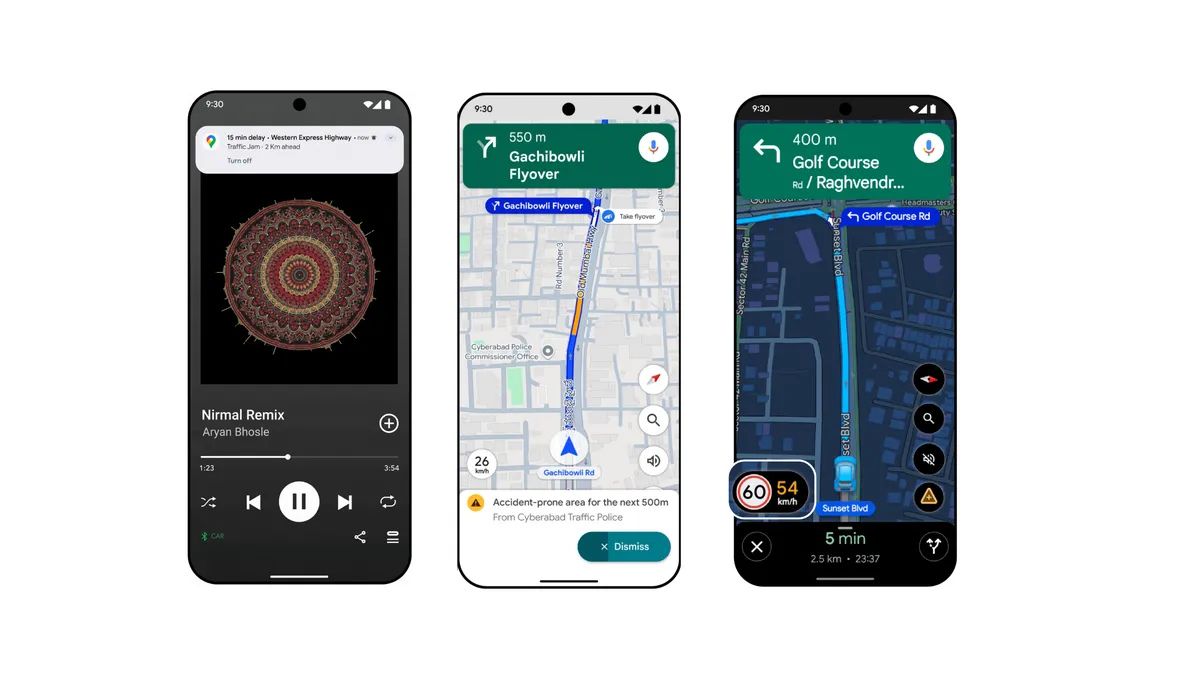
Proactive Traffic Alerts
Proactive Traffic Alerts will automatically notify you when there’s a major disruption or delay on the road ahead. You will know how bad the delay is and how much time will be added to your ETA. Along with the US, this feature is now rolling out in India to Android users for highways and major roads in New Delhi, Mumbai, and Bangalore.
Alerts for accident-prone areas
The Accident-Prone Area alerts feature is designed for India and is built in partnership with government authorities. Now, based on authoritative data from city authorities, Maps will alert you visually and through voice as you approach these areas on your route so you can slow down and drive safely. This feature is rolling out to Android users in Gurugram, Cyberabad, Chandigarh, and Faridabad.
See official speed limits
Authoritative speed limit data from local traffic authorities is being mapped in Google Maps. While navigating, Maps will display the official speed limit for your road right next to the speedometer in the app, helping you drive with more confidence. This feature is rolling out to both Android and iOS users in 9 Indian cities: Faridabad, Ghaziabad, Gurugram, Hyderabad (including Cyberabad), Jaipur, Kolkata, Lucknow, Mumbai, and Noida.
Google has also announced the start of a new partnership with the National Highways Authority of India (NHAI). NHAI will share near-real-time, authoritative data on road closures and repairs. This partnership will also enable to surface of information for wayside amenities like public restrooms, eateries, and petrol stations.